Van Duzen River
Van Duzen Environmental Stewards (YES)
The Place
The Van Duzen River basin ranges from 62 feet to 5,096 feet above sea level. Its headwaters begin in the mountains of the California Coastal Range, and flow through oak woodlands, grasslands, and lower elevation redwood forest before joining the Eel River seventeen miles north of Eureka, California. The watershed supports important agricultural and timber operations and the entire Eel River system supports important fisheries including threatened and endangered anadromous (freshwater/saltwater) salmon.
The Issue
The moment in time for the YES group came in 1998 when the Van Duzen watershed was recognized as an impaired water body by the Environmental Protection Agency (EPA). As a result of a lawsuit, the EPA committed to establishing a Total Maximum Daily Load (TMDL) for sedimentation that inspired the local landowners to get engaged.
The Story
The cattle-ranching landowners in the Van Duzen watershed worked with EPA to conduct an assessment of the watershed to determine potential sources of sedimentation. This was followed by collection of historical data from long-time residents about how the land use and condition had changed over time in the basin. These efforts led to additional opportunities for trust to develop between the community and government partners. These initial efforts culminated in the discovery that ranch road design and maintenance were the primary sources of sedimentation in the middle reaches of the watershed where the landowners lived and worked. The relationships and trust built during the data collection and planning process led to many opportunities for cooperation during implementation of best management practices to reduce sedimentation. The YES group, eventually incorporated as a nonprofit organization, governed by a volunteer board and conducts work through volunteer committees that deal with different aspects of the collaboration.
The Partners
YES has partnered with many public partners. Initially, the primary partner was the Environmental Protection Agency but the list of partners quickly grew to include other federal agencies as well as state and local agencies, universities, nonprofit organizations, and private engineering and consulting firms.
The Results
One of the mottos of YES is “Coming together is a beginning, working together is progress, staying together is success.” Working together, both among neighbors and between the community and agencies, has required much time and effort, but the group has managed to voluntarily address a public resource concern within the watershed. The group has received numerous grants totaling over $6 million to address sites producing excess sediment, primarily improving drainage and stream crossings on private ranch roads. This has improved water quality which has benefitted fisheries and endangered species habitat. As YES comes to a completion of the work of reducing sediment that started 10 years ago, the organization is beginning to shift its focus to working locally with a variety of organizations encouraging collaborative approaches to addressing resource issues on working landscapes.
Forest Management Plans as Part of a Ranch Strategy

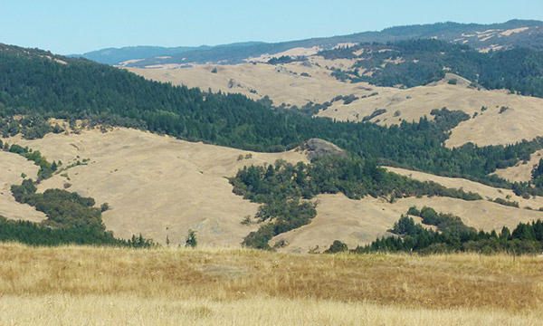
Photo: Van Duzen Landscape
The middle domain of the Van Duzen watershed is an area of mixed grassland and timber with the primary land use being cattle grazing.
(Photo by Heather Johnson, USFWS)

